Final webinar
BONUS BASMATI – Supporting Maritime Spatial Planning with Science
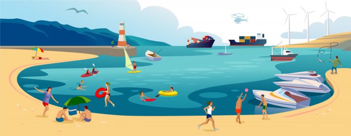
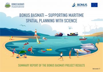
The final dissemination activities of the BONUS BASMATI project consist of three main products – all presented with the overall title ‘Supporting Maritime Spatial Planning with Science’. The main products summarising the project outcomes are:
The BONUS BASMATI summary video
The BONUS BASMATI summary report
The BONUS BASMATI final seminar
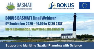
The final seminar was organised as a forenoon online webinar on Wednesday, the 9th of September, 2020. The webinar presentations and further online material are listed below.
Welcome words
- Welcome words (YouTube)
- Short introduction of dissemination activities (YouTube)
Concepts and approaches
Framework for sustainability impact assessment of plan proposals
- The webinar presentation (YouTube)
- The webinar slideshow (pdf)
Assessment of ecosystem services and values of marine protected areas
- The webinar presentation (YouTube)
- The webinar slideshow (pdf)
Data harmonisation to facilitate planning across borders and scales
- The webinar presentation (YouTube)
- The webinar slideshow (pdf)
- Scientific article: Lost in space and time? A conceptual framework to harmonise data for marine spatial planning (website)
- Baltic Sea Atlas (website)
Involving stakeholders – Why, Who, When and How?
- The webinar presentation (YouTube)
- The webinar slideshow (pdf)
- BONUS BASMATI handbook: Process, Methods and Tools for Stakeholder Involvement in Maritime Spatial Planning (pdf)
- Executive summaries of the handbook: English, Danish, Finnish, German, Latvian, Swedish (pdf)
- A lecture on Involving Stakeholders in MSP: Purposes, Process, Methods, Tools (YouTube, 35 min)
- The lecture slideshow (pdf)
Platforms and tools for MSP
Baltic Explorer – collaborative GIS approach for new interactive MSP
- The webinar presentation (YouTube)
- The webinar slideshow (pdf)
- Baltic Explorer introduction video (YouTube)
- Baltic Explorer (website)
- Source code (website)
SPACEA – a GIS toolbox to facilitate easy spatial and environmental suitability analysis
- The webinar presentation (YouTube)
- The webinar slideshow (pdf)
ESA4MSP – an ecosystem service assessment tool
- The webinar presentation (YouTube)
- The webinar slideshow (pdf)
MYTILUS – a toolset for assessing the impacts of maritime activities
- The webinar presentation (YouTube)
- The webinar slideshow (pdf)
SEANERGY – a tool for analysing conflicts and synergies between different marine uses
- The webinar presentation (YouTube)
- The webinar slideshow (pdf)
Closing words